Challenges in creating and managing a dynamic international spatial database
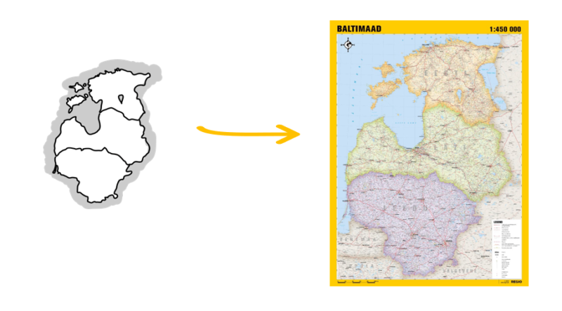
One of Regio’s main activities is the maintenance and continuous updating of the geospatial database of the Baltic States. Accurate and up-to-date data ensure that our clients’ mapping applications provide reliable information across the entire Baltic region. Correct address and navigation data help our clients easily find their destinations and offer better services to their users. Whether it involves addresses, road networks, building footprints, or points of interest (POI) and areas of interest (AOI), our data assist businesses and individuals in spatial navigation and making precise decisions.
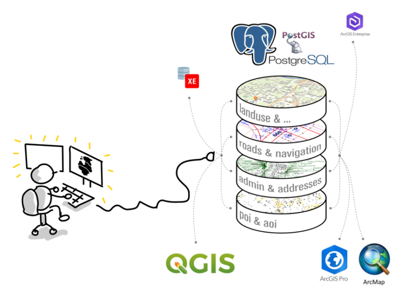
In 2024, we implemented a significant technological upgrade by migrating our database from Oracle to the PostgreSQL database management system. Combined with QGIS software, this transition has enabled us to process data more efficiently and manage it more effectively.
Managing a dynamic and international spatial database comes with various challenges, which we will explain in more detail below.
Local expertise in all three Baltic states
Our daily operations involve maintaining data with a unified structure and precision for three different countries. This means our clients do not have to struggle with integrating different systems and data structures—we take care of it for them.
We utilize a wide range of data sources to ensure our information remains up-to-date and continuously adapt to technological advancements. This approach allows us to meet client expectations and provide them with the freshest and most accurate data available.
Managing a unified database across three countries demands extensive expertise and high precision. Our team is well-versed in the unique characteristics of all three Baltic states, from linguistic nuances to differences in traffic regulations. The Latvian and Lithuanian languages are no longer intimidating when specialized terms such as įkrovimo stotelė (charging station), šķērslīnija (cross street), apylinkių seniūnija (suburban district), or pilsētiņa (small town) become both clear and meaningful.
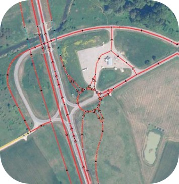
We have thoroughly studied and analyzed the traffic regulations of each country, investing countless hours and days to refine navigation data for both major and minor traffic hubs. As a result, our database contains highly accurate information, including the number of road lanes, speed limits, street names, highway numbers, turn restrictions, information on signboards, and various traffic regulations based on vehicle type, weight, height, or width. This level of detail enables us to provide data that support precise and reliable navigation.
Continuous data updates
Adding new data to the database once or assembling a data layer from multiple sources is relatively simple. However, the real challenge lies in ensuring the continuous and consistent updating of data.
To update our database, we use two main strategies: either replacing the entire dataset with a newer version each time or tracking changes in source data and updating only the modified features.
Replacing the entire dataset may initially seem like a simpler and faster approach, but it requires a uniform database structure across all three Baltic countries. However, each country has different data sources, and their table structures and geometry rules may not align with our standards. Therefore, data must always be cleaned and standardized.
Detecting and processing data changes
With this method, we compare source data at different time intervals, such as monthly or semi-annually. We identify modifications and integrate them into our database while maintaining table relationships and previous corrections.
This approach allows us to regularly update addresses, points of interest (POIs), buildings, roads, and administrative boundaries, ensuring the accuracy and consistency of our database.
Data entry into database and automation of processes
Data updates and entries are performed either manually or automatically.
Manual updates: A GIS specialist makes necessary changes in QGIS software using plugins specifically designed to align with our database structure and rules. Although time-consuming, this method gives full control and a precise overview of the data and processes.
Automated updates: PostgreSQL database procedures accelerate data processing and streamline the workflow. However, automation requires extensive development work and carries risks, such as inconsistencies in source table structures, ID mismatches, or loss of data availability.
Automation is most beneficial when dealing with frequently updated data from reliable sources, such as POIs or addresses.
What’s next?
The challenges of managing a dynamic international database and ensuring high-quality data remain similar, even as the database expands to additional countries. We have developed a universal system that allows for the seamless integration of new country datasets while leveraging our existing data cleaning and management processes.
From a spatial data geometry perspective, automatic corrections for point and area geometries are relatively straightforward using standard GIS tools. However, automated processing and updating of linear features, such as roads and boundaries, is more complex. Our goal is to develop an efficient system for precise and automated management of these elements.
Additionally, certain spatial data categories, such as navigation data, are becoming increasingly time sensitive. The integration of real-time data is becoming a crucial aspect of this field. This is one of the key areas where we see significant future potential and opportunities to further enhance our solutions.


